Montmayeur Castle, by Grand Haury

Edited by:
Massimo Martini
Updated at: 25/08/2026
Access
From the Aosta Ovest motorway junction , take the slip road towards the in the direction of Sarre and the Aosta Valley State Road 26, for 950m (950m). At the roundabout, turn left onto the and follow it for 4.3km (5.25km). At the next roundabout, take the first exit, staying on the for a further 550m (5.8km), then continue with a slight right-hand bend, staying on the for 850m (6.65km), and keep left for a further 2.8km (9.45km), still on the , towards Arvier. At the next roundabout, take the 3rd exit onto Via Lostan for 300m (9.75km). Carry on straight ahead when the road bends to the right and becomes Via Saint Antoine, for 850m (10.6km), then turn left and continue for 350m (10.95km). Turn right and carry on for 3.2km (14.15km), then carry on straight for the final 350m (14.5km) to Grand Haury.
Car park
In the hamlet of Grand Haury there is a free 🅿️ car park at the end of the road, which is the starting point of the route.
Access by public transport
You will need a private vehicle to reach the starting point of the route, as the village is not served by public transport.
Distance and journey time
🕒 Journey time: 21 minutes
📏 Distance: 14.5 km
GPS navigation
Important information
The directions provided were verified on the date the route was mapped. Before setting off, we recommend checking for any changes to the route or road conditions. For up-to-date information, please consult Google Maps or Apple Maps.
Introduction
A route that climbs from the hamlet of Grand-Haury, in the municipality of Arvier, to the ruins of Montmayeur Castle, perched on a rocky outcrop at the head of the Valgrisenche, on the right bank of the Dora Valgrisenche. The route crosses the edge of the meadows surrounding the village and a strip of land that was once marshy but has now been reclaimed, running alongside a stream before climbing up to the castle promontory, through a low-altitude alpine landscape of pastures and short wooded stretches.
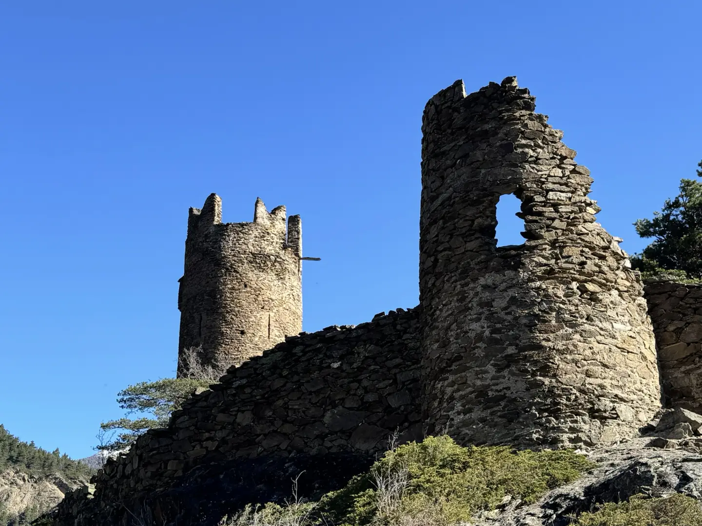
The main reason for the trip is to visit the ruins of the castle, founded in 1271 at the behest of the lords ofAvise with the permission of Philip of Savoy: of the original structure, the circular tower, crowned with swallow-tail battlements, and some sections of the ramparts remain standing. The route also passes through the historic centre of Grand-Haury.
The modest elevation gain and low starting altitude make the route accessible for most of the year, except in the event of snow or slippery ground in the formerly marshy section following rainfall. The route is short and presents no significant technical difficulties.
Description
0h00' 0.00km From the car park 🅿️ in the square before thevillage (1,171m), take the path, which branches off beneath a vaulted passageway between two old houses at the entrance to the village of Grand-Haury. Descend across several meadows and a stretch that was once marshy but has now been drained, following a stream as you lose altitude to the lowest point of the route (1,115m), where you reach thejunction with path , coming from the Valgrisenche regional road.
0h08' 0.62km Turn right onto path and head uphill, following a route that is undulating in places, towards the rocky spur on which Montmayeur Castle stands (1,141m) 0h15' 0.88km . Of the castle, founded in 1271, the circular crenellated tower with swallow-tail battlements and sections of the ramparts remain standing; the building is currently privately owned.
The return journey follows the same route 0h15' 0.88km .
Visitor information
The castle is situated on private property, although it can be reached via a public footpath: please do not cross any fences or ignore any signs on site. Accessibility status to be confirmed.
Comments (0)
Sign in to leave a comment